



Hurricane season: two weather systems under observation
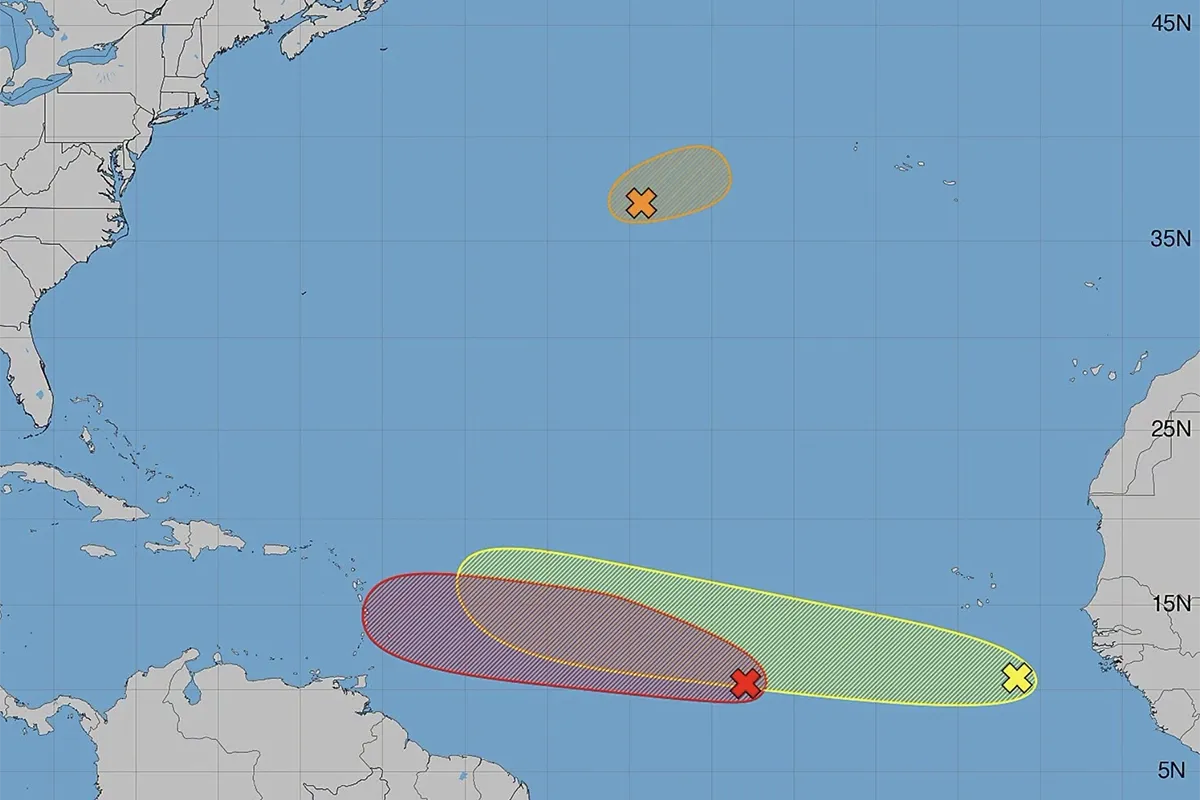
After a fairly quiet start to the season, things are picking up a bit in the Atlantic. This weekend is set to be marked by bad weather… reminding us that we need to be prepared, and that we must keep an eye on any disturbances.
Invest 92L is indeed continuing to organise itself in the middle of the Atlantic. The National Hurricane Centre now estimates the probability of a tropical depression forming at 80 per cent, both over the next 48 hours and over the next seven days. The system is continuing its west-north-westerly track and could approach the northern half of the Lesser Antilles over the weekend. For the time being, conditions are favourable for its development, and some models even suggest it could develop into a tropical storm. However, as it approaches the Caribbean arc, conditions could become less favourable: wind shear is expected to increase whilst the air is set to become drier, particularly due to Saharan dust. A weakening or breakdown of the system therefore remains the most likely scenario at this stage. Its exact track, however, remains uncertain and will need to be monitored in subsequent bulletins. According to Météo France, it could affect the Caribbean arc between Friday evening and Sunday as a strong tropical wave or tropical depression, or even a weak tropical storm. Behind this disturbance, a second tropical wave, which recently emerged off the African coast, is also being monitored. Although still poorly organised, it could nevertheless encounter more favourable conditions in the coming days. The NHC currently estimates its risk of formation at 20 per cent within 48 hours and 30 per cent over seven days. So there is nothing to alarm at this stage, but this renewed activity serves as a reminder that we are now well into the most active period of the hurricane season and that it is important to stay informed and keep up to date with weather forecasts.